
世界中に100万以上ある都市や町、村。それぞれがどのような「かたち」をとっているのかを知ることは、人類の文明の歴史を深く理解したり、今後の都市計画を進めるうえで非常に重要です。これまでは人の手作業による定性的な解析に止まりがちだった都市の「形態」を、Deep Learningを用いて解析、分類しようとする試みです。
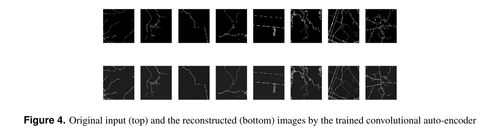
用いるデータはOpenStreetMapのデータで、道路の情報のみを扱っています(建物や土地の利用形態についての情報は無視)。一般的な畳み込みニューラルネットワークを用いたAutoEncoderをまずは学習します。以下は学習したAutoEncoderのインプット(上段)とアウトプット(下段)の例ですが、きれいにインプットが再現されていることがわかります。
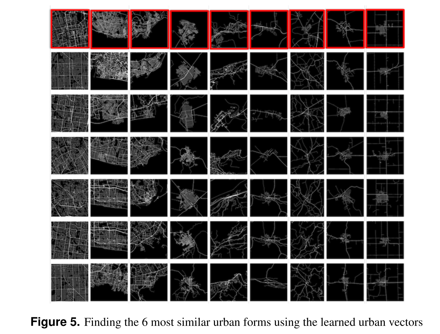
こうして学習したAutoEncoderの中間層の出力を、その都市の形状を表す特徴ベクトルとして扱うことで、都市の形状の類似度を距離として算出することができるようになります。
下のイメージは、最上段の都市の形状に類似する、他の都市6つを表示したものです。
データセットにある全ての都市に対して、この特徴ベクトルを算出し、それらを一次元のSOM(Self Organizing Map)によってクラスタリングすることで、シンプルな形状の村から複雑なメガロポリスまで、順に並べることが可能になりました。
こうして得られた情報を地図上にマッピングしたのが次の図です。
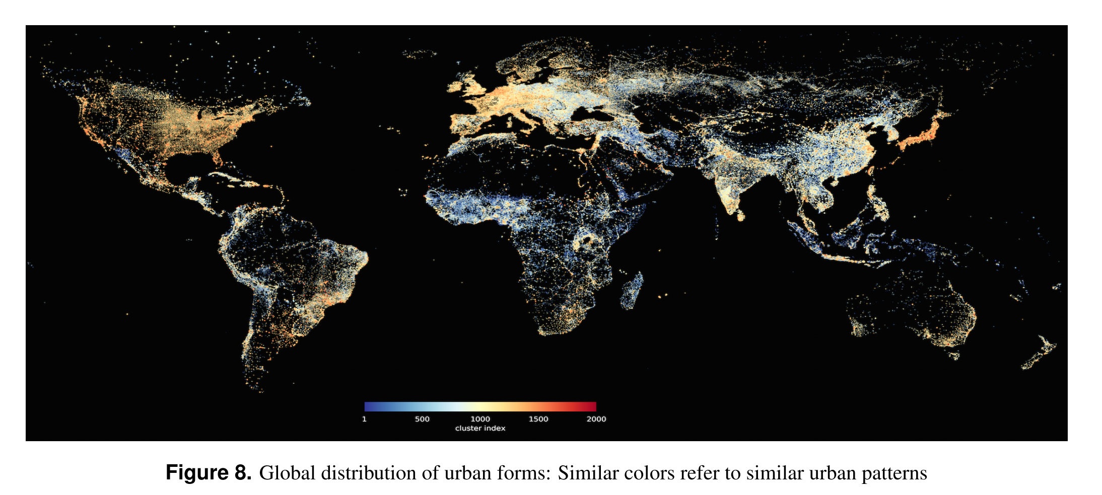
日本やアメリカ、ヨーロッパなどの一部に人口の密集した巨大な都市が集中しているのがわかります。
大量のデータをもって世界を俯瞰的にみる視点。今後も事例が増えていきそうな領域です。
Study of urban form is an important area of research in urban planning/design that contributes to our understanding of how cities function and evolve. However, classical approaches are based on very limited observations and inconsistent methods. As an alternative, availability of massive urban data collections such as Open Street Map from the one hand and the recent advancements in machine learning methods such as deep learning techniques on the other have opened up new possibilities to automatically investigate urban forms at the global scale. In this work for the first time, by collecting a large data set of street networks in more than one million cities, towns and villages all over the world, we trained a deep convolutional auto-encoder, that automatically learns the hierarchical structures of urban forms and represents them via dense and comparable vectors. We showed how the learned urban vectors could be used for different investigations. Using the learned urban vectors, one is able to easily find and compare similar urban forms all over the world, considering their overall spatial structure and other factors such as orientation, graphical structure, and density and partial deformations. Further cluster analysis reveals the distribution of the main patterns of urban forms all over the planet.
Introduction