LINK
国勢調査の結果と衛星写真の関係を学習することで、空から見た写真をもとにその土地に住む住民の所得レベルを推定するツールを作ったというものです.
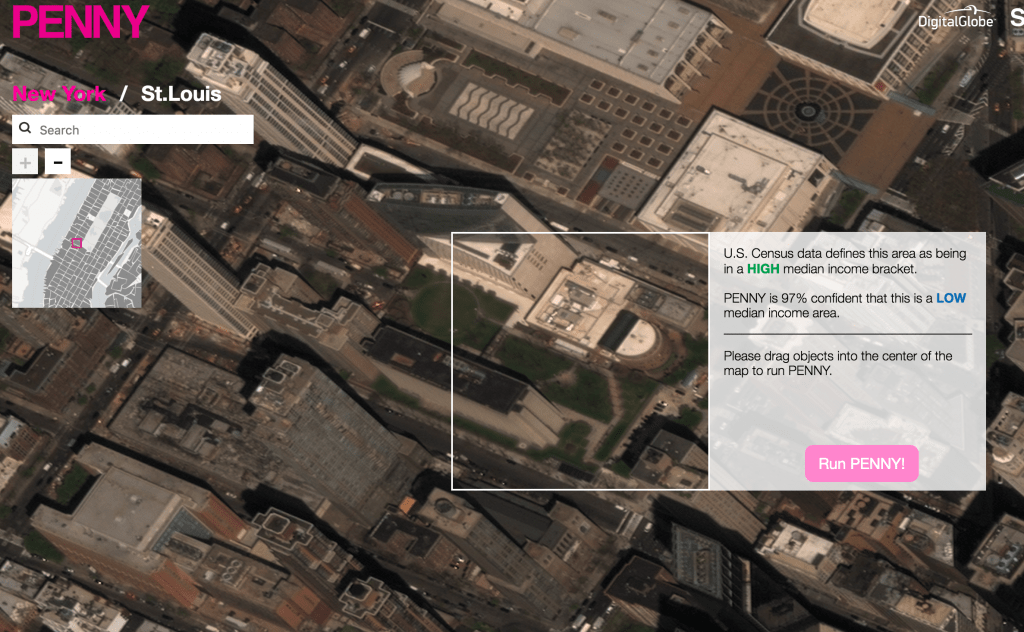
衛星写真の上に、高層マンションや駐車場といった建物を置いていくことで、推定される所得レベルがどう変わるのか試すことができるのも面白いですね. テニスコートを置くと、所得が向上したのに対し、野球場やバスケのコートは下がる..といったあたりから、社会の縮図が透けて見えてきます.
We trained an AI to predict wealth from space.
Penny is a simple tool to help us understand what wealth and poverty look like to an artificial intelligence built on machine learning using neural networks. The tool lets you play around with the landscape of a city, by adding and removing urban features like buildings, parks, and freeways in high-resolution satellite imagery.